
Thank you for supporting this site ❤️
Make a donation
Make a donation
Gear up for your next adventure:
As an Amazon Associate, this site earns from qualifying purchases at no extra cost to you.
Perinaldo topographic map
Click on the map to display elevation.
Thank you for supporting this site ❤️
Make a donation
Make a donation
Gear up for your next adventure:
As an Amazon Associate, this site earns from qualifying purchases at no extra cost to you.
About this map
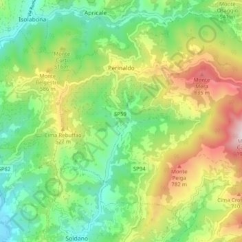
Name: Perinaldo topographic map, elevation, terrain.
Location: Perinaldo, Imperia, Liguria, 18032, Italy (43.83036 7.64671 43.88025 7.72403)
Average elevation: 390 m
Minimum elevation: 27 m
Maximum elevation: 1,012 m
Thank you for supporting this site ❤️
Make a donation
Make a donation
Gear up for your next adventure:
As an Amazon Associate, this site earns from qualifying purchases at no extra cost to you.