Geolocate

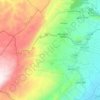
Labweh topographic map

Click on the map to display elevation.

About this map

Name: Labweh topographic map, elevation, terrain.

Location: Labweh, Baalbek District, Baalbek-Hermel Governorate, Lebanon (34.17586 36.33589 34.21586 36.37589)

Average elevation: 987 m

Minimum elevation: 837 m

Maximum elevation: 1,487 m

Other topographic maps

Click on a map to view its topography, its elevation and its terrain.

Shmestar

Lebanon > Baalbek-Hermel Governorate

Average elevation: 1,210 m

Deir El Ahmar

Lebanon > Baalbek-Hermel Governorate

Average elevation: 1,148 m

Maqnah

Lebanon > Baalbek-Hermel Governorate

Average elevation: 1,063 m

Baalbek

Lebanon > Baalbek-Hermel Governorate

Average elevation: 1,218 m

Taraya

Lebanon > Baalbek-Hermel Governorate

Average elevation: 1,551 m

Harbata

Lebanon > Baalbek-Hermel Governorate

Average elevation: 1,307 m

Hermel

Lebanon > Baalbek-Hermel Governorate

Average elevation: 813 m

Beshwat

Lebanon > Baalbek-Hermel Governorate

Average elevation: 1,321 m

Beit Shama

Lebanon > Baalbek-Hermel Governorate

Average elevation: 1,056 m

Gear up for your next adventure:

⛺Camping Groundsheet - Protect your tent from moisture and dirt
🧢Hiking Hat - Sun-protective and breathable hats for long treks
🧭GPS Handheld Device - Reliable GPS navigation for outdoor adventures
🛶Kayak Dry Bag - Waterproof storage for kayaking adventures
💧Collapsible Water Bottle - Space-saving water bottle for outdoor activities

As an Amazon Associate, this site earns from qualifying purchases at no extra cost to you.