

Parkland topographic map
Click on the map to display elevation.
About this map
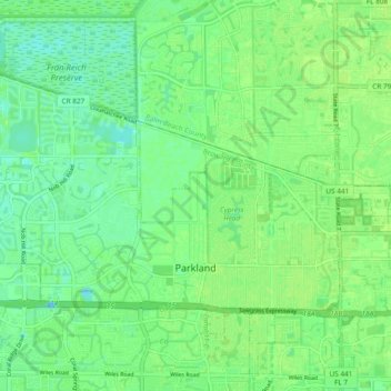
Name: Parkland topographic map, elevation, terrain.
Location: Parkland, Broward County, Florida, United States (26.29575 -80.29708 26.35549 -80.20241)
Average elevation: 7 m
Minimum elevation: -4 m
Maximum elevation: 11 m
Other topographic maps
Click on a map to view its topography, its elevation and its terrain.

Ro-Len Lake Gardens
United States > Florida > Broward County > Hallandale Beach
Average elevation: 7 m

Chapel Trail Nature Preserve
United States > Florida > Broward County > Pembroke Pines
Average elevation: 4 m


Bonita Bay
United States > Florida > Broward County > Fort Lauderdale > Soroka Shores
Average elevation: 4 m


Deerfield Beach Century Village
United States > Florida > Broward County > Deerfield Beach
Average elevation: 8 m
Fort Lauderdale Beach
United States > Florida > Broward County > Fort Lauderdale > Birch Ocean Front
Average elevation: 3 m


Bonita Bay
United States > Florida > Broward County > Fort Lauderdale > Soroka Shores
Average elevation: 4 m


