Geolocate

Pilot topographic map

Click on the map to display elevation.

About this map

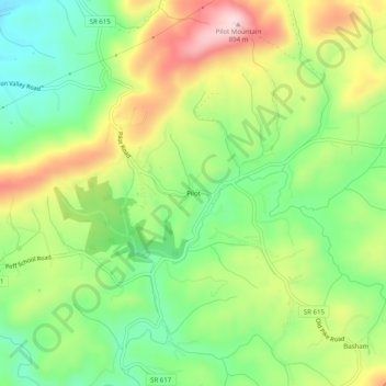
Name: Pilot topographic map, elevation, terrain.

Location: Pilot, Montgomery County, Virginia, 24138, United States (37.03208 -80.38366 37.07208 -80.34366)

Average elevation: 722 m

Minimum elevation: 603 m

Maximum elevation: 887 m

Gear up for your next adventure:

🥾Durable Hiking Shoes - Long-lasting shoes for frequent hiking
🥾Hiking Shorts - Breathable shorts suitable for summer hikes
🧴Waterproofing Spray - Restore the DWR coating on jackets and tents
Camping Coffee Maker - Brew fresh coffee anywhere on the topographic map
🦌Outdoor Trail Camera - Monitor wildlife activity near your favorite spots

As an Amazon Associate, this site earns from qualifying purchases at no extra cost to you.