

Torrevieja topographic map
Click on the map to display elevation.
About this map
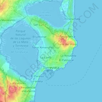
Name: Torrevieja topographic map, elevation, terrain.
Average elevation: 7 m
Minimum elevation: -9 m
Maximum elevation: 72 m
Other topographic maps
Click on a map to view its topography, its elevation and its terrain.

La Marina
Spain > Valencian Community > el Baix Segura / La Vega Baja > Guardamar del Segura
Average elevation: 7 m
La Mata
Spain > Valencian Community > el Baix Segura / La Vega Baja > Torrevieja
Average elevation: 5 m
Raiguero de Bonanza
Spain > Valencian Community > el Baix Segura / La Vega Baja > Orihuela
Average elevation: 139 m
La Mata
Spain > Valencian Community > el Baix Segura / La Vega Baja > Torrevieja
Average elevation: 5 m