Geolocate

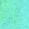
Sukolilo topographic map

Click on the map to display elevation.

About this map

Name: Sukolilo topographic map, elevation, terrain.

Location: Sukolilo, Surabaya, East Java, Java, Indonesia (-7.31080 112.76188 -7.26743 112.84668)

Average elevation: 3 m

Minimum elevation: -4 m

Maximum elevation: 9 m

Other topographic maps

Click on a map to view its topography, its elevation and its terrain.

Caribbean Island

Indonesia > East Java > Surabaya > Keputih

Average elevation: 0 m

Taman Harmoni

Indonesia > East Java > Surabaya

Average elevation: 2 m

Taman Flora

Indonesia > East Java > Surabaya > Baratajaya

Average elevation: 5 m

Taman Suroboyo

Indonesia > East Java > Surabaya

Average elevation: 1 m

Caribbean Island

Indonesia > East Java > Surabaya

Average elevation: 0 m

Canberra

Indonesia > East Java > Surabaya > Manukan Wetan

Average elevation: 4 m

Taman Pelangi

Indonesia > East Java > Surabaya > Gayungan

Average elevation: 6 m

Gear up for your next adventure:

🎒Hiking Backpack - Lightweight and ergonomic backpacks for day hikes or multi-day treks
🧢Sun Protection Cap - Breathable cap to protect from sun exposure
🧥Thermal Layer - Insulating layer for cold outdoor conditions
🥾Mountain Trail Shoes - High-traction shoes for mountain trails
🔥Emergency Fire Starter - Reliable ignition source for all weather conditions

As an Amazon Associate, this site earns from qualifying purchases at no extra cost to you.