Geolocate

Kriegenbrunn topographic map

Click on the map to display elevation.

About this map

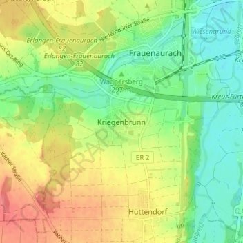
Name: Kriegenbrunn topographic map, elevation, terrain.

Location: Kriegenbrunn, Erlangen, Bavaria, 91056, Germany (49.53644 10.93424 49.57644 10.97424)

Average elevation: 302 m

Minimum elevation: 271 m

Maximum elevation: 342 m

Gear up for your next adventure:

🧣Merino Neck Gaiter - Protects against wind, sun, and cold at high altitudes
🔦UV Flashlight - Detect minerals or specific insects in the dark
🧦Thermal Socks - Warm socks for winter hiking or camping
👟Sport Hiking Sandals - Breathable footwear for water crossings and camp rest
🚲MTB Frame Bag - Carry tools and maps directly on your bicycle frame

As an Amazon Associate, this site earns from qualifying purchases at no extra cost to you.