Geolocate

Untertürkheim topographic map

Click on the map to display elevation.

About this map

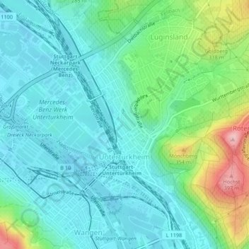
Name: Untertürkheim topographic map, elevation, terrain.

Location: Untertürkheim, Stuttgart, Baden-Württemberg, 70327, Germany (48.77115 9.23980 48.79618 9.26918)

Average elevation: 261 m

Minimum elevation: 217 m

Maximum elevation: 402 m

Gear up for your next adventure:

🥾Hiking Leggings - Comfortable leggings for outdoor activities
🧢Sun Protection Cap - Breathable cap to protect from sun exposure
Lightweight Camping Tent - Portable shelter optimized for Canadian backcountry camping
🥾Lightweight Hiking Shoes - Comfortable shoes for day hikes
🏃Hydration Running Vest - Carry water and maps close to your body for speed

As an Amazon Associate, this site earns from qualifying purchases at no extra cost to you.