

Statesboro topographic map
Click on the map to display elevation.
Statesboro
According to the United States Census Bureau, the city has a total area of 13.9 square miles (35.9 km2), of which 13.5 square miles (35.0 km2) is land and 0.35 square miles (0.9 km2), or 2.60%, is water. The city is in the coastal plain region, or Low Country, of Georgia, so it is mainly flat with a few small hills. With an elevation of 250 feet (76 m), the downtown area is one of the highest places in Bulloch County. Pine, oak, magnolia, dogwood, palm, sweetgum, and a variety of other trees can be found in the area.
About this map
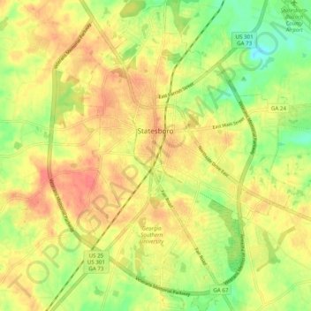
Name: Statesboro topographic map, elevation, terrain.
Location: Statesboro, Bulloch County, Georgia, United States (32.38516 -81.80804 32.48885 -81.73140)
Average elevation: 64 m
Minimum elevation: 37 m
Maximum elevation: 86 m
Other topographic maps
Click on a map to view its topography, its elevation and its terrain.


