Geolocate

Kishtwar topographic map

Click on the map to display elevation.

About this map

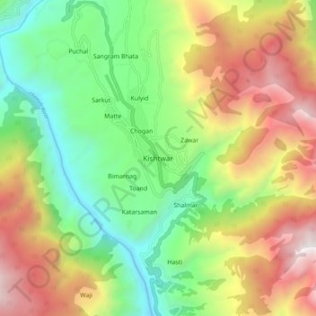
Name: Kishtwar topographic map, elevation, terrain.

Location: Kishtwar, Jammu and Kashmir, 182204, India (33.27079 75.72942 33.35079 75.80942)

Average elevation: 1,935 m

Minimum elevation: 1,028 m

Maximum elevation: 3,215 m

Gear up for your next adventure:

🥾Trail Hiking Boots - Supportive boots for rough trails
🧴Bear Spray Holster - Quick-access carry for essential Canadian wilderness safety
🛶Waterproof Dry Bags - Keep electronics and clothes dry during river crossings
🥾Waterproof Trail Shoes - Shoes designed to handle wet terrain
🥫Freeze-Dried Meals - Lightweight, high-calorie nutrition for multi-day treks

As an Amazon Associate, this site earns from qualifying purchases at no extra cost to you.