Geolocate

Westlake topographic map

Click on the map to display elevation.

About this map

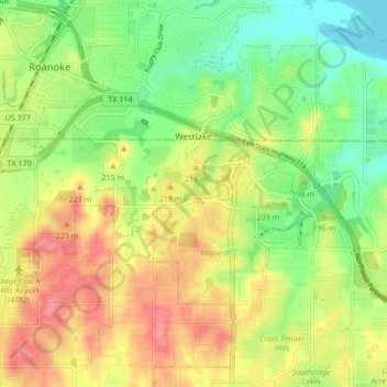
Name: Westlake topographic map, elevation, terrain.

Location: Westlake, Denton County, Texas, United States (32.96025 -97.24635 33.00104 -97.16166)

Average elevation: 199 m

Minimum elevation: 161 m

Maximum elevation: 242 m

Other topographic maps

Click on a map to view its topography, its elevation and its terrain.

Gear up for your next adventure:

🥾Mountaineering Boots - Supportive boots for climbing and high-altitude hiking
🧥Softshell Hiking Jacket - The perfect balance of wind protection and breathability
🥾Hiking Boots - Sturdy boots providing ankle support and traction on rugged trails
🧴Waterproofing Spray - Restore the DWR coating on jackets and tents
🕶️Polarized Sunglasses - Protect your eyes with durable polarized lenses

As an Amazon Associate, this site earns from qualifying purchases at no extra cost to you.