Geolocate

Albarracín topographic map

Click on the map to display elevation.

About this map

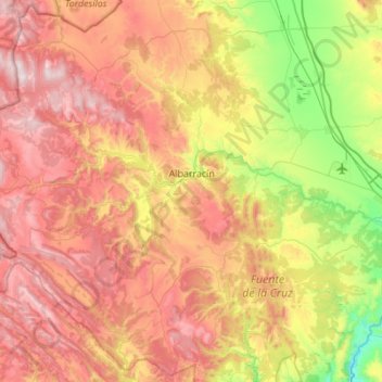
Name: Albarracín topographic map, elevation, terrain.

Location: Albarracín, Sierra de Albarracín, Teruel, Aragon, Spain (40.18504 -1.80644 40.58996 -1.25624)

Average elevation: 1,330 m

Minimum elevation: 790 m

Maximum elevation: 1,924 m

Gear up for your next adventure:

Tent Footprint - Protect tent floor and increase durability
💡LED Camping Lantern - Illuminate your campsite with long-lasting lanterns
🦌Outdoor Trail Camera - Monitor wildlife activity near your favorite spots
🔪Outdoor Multitool - Versatile tool for repairs and food prep in the wild
🐕Hiking Dog Pack - Let your canine companion carry their own water and food

As an Amazon Associate, this site earns from qualifying purchases at no extra cost to you.