Geolocate

Senni topographic map

Click on the map to display elevation.

About this map
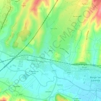
Name: Senni topographic map, elevation, terrain.

Location: Senni, Unione Montana dei Comuni del Mugello, Florence, Tuscany, 50032, Italy (43.94544 11.34163 43.98544 11.38163)

Average elevation: 218 m

Minimum elevation: 184 m

Maximum elevation: 289 m

Other topographic maps

Click on a map to view its topography, its elevation and its terrain.
Fucecchio

Italy > Tuscany > Florence

Average elevation: 34 m

Scarperia e San Piero

Italy > Tuscany > Florence

Average elevation: 430 m

Gear up for your next adventure:

🔦LED Flashlight - Powerful and long-lasting flashlight for camping and emergencies
🧼Travel Hand Sanitizer - Keep hands clean when water is scarce
👟Sport Hiking Sandals - Breathable footwear for water crossings and camp rest
⛺Lightweight Camping Tent - Portable shelter optimized for Canadian backcountry camping
🧭GPS Handheld Device - Reliable GPS navigation for outdoor adventures

As an Amazon Associate, this site earns from qualifying purchases at no extra cost to you.