Geolocate

Plantation topographic map

Click on the map to display elevation.

About this map

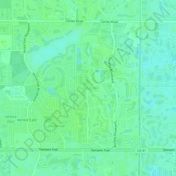
Name: Plantation topographic map, elevation, terrain.

Location: Plantation, Sarasota County, Florida, 34293, United States (27.04373 -82.38516 27.08373 -82.34516)

Average elevation: 5 m

Minimum elevation: 0 m

Maximum elevation: 10 m

Other topographic maps

Click on a map to view its topography, its elevation and its terrain.

Bee Ridge

United States > Florida > Sarasota County > Bee Ridge

Average elevation: 13 m

Nokomis

United States > Florida > Sarasota County

Average elevation: 5 m

Gear up for your next adventure:

💧Hydration Bladder - Hands-free hydration solution for long treks
🧢Beanie Hat - Keep your head warm in cold weather
💡Portable Camping Lamp - Rechargeable lamp for campsite lighting
🧭GPS Handheld Device - Reliable GPS navigation for outdoor adventures
🧴Outdoor Sunscreen - High SPF protection for high-altitude UV exposure

As an Amazon Associate, this site earns from qualifying purchases at no extra cost to you.