
Thank you for supporting this site ❤️
Make a donation
Make a donation
Gear up for your next adventure:
As an Amazon Associate, this site earns from qualifying purchases at no extra cost to you.
Arrifana topographic map
Click on the map to display elevation.
Thank you for supporting this site ❤️
Make a donation
Make a donation
Gear up for your next adventure:
As an Amazon Associate, this site earns from qualifying purchases at no extra cost to you.
About this map
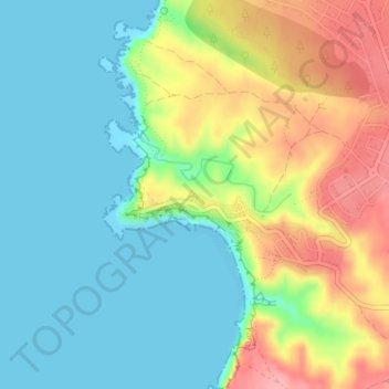
Name: Arrifana topographic map, elevation, terrain.
Location: Arrifana, Aljezur, Faro, 8670-111, Portugal (37.29235 -8.87677 37.30273 -8.85937)
Average elevation: 39 m
Minimum elevation: 0 m
Maximum elevation: 110 m
Thank you for supporting this site ❤️
Make a donation
Make a donation
Gear up for your next adventure:
As an Amazon Associate, this site earns from qualifying purchases at no extra cost to you.