
Kendall topographic map
Click on the map to display elevation.
About this map
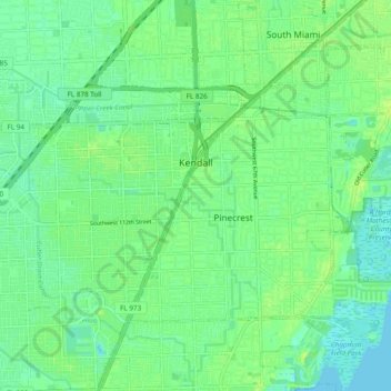
Name: Kendall topographic map, elevation, terrain.
Location: Kendall, Miami-Dade County, Florida, United States (25.62870 -80.38906 25.71507 -80.30508)
Average elevation: 7 m
Minimum elevation: -1 m
Maximum elevation: 16 m
Other topographic maps
Click on a map to view its topography, its elevation and its terrain.
Key Biscayne
United States > Florida > Miami-Dade County
Key Biscayne lies south of Miami Beach and east of Miami. The village is connected to Miami via the Rickenbacker Causeway, originally built in 1947. Because of its low elevation and direct exposure to the Atlantic Ocean, it is usually among the first Miami areas to be evacuated before an oncoming hurricane.
Average elevation: 3 m
Virginia Key Beach North Point Park
United States > Florida > Miami-Dade County > Miami
Average elevation: 3 m
Shady Oaks Trailer Park
United States > Florida > Miami-Dade County > North Miami
Average elevation: 9 m
Bal Harbor Beach
United States > Florida > Miami-Dade County > Bal Harbour Village
Average elevation: 3 m
Hibiscus Point Mobile Home Park
United States > Florida > Miami-Dade County > Hialeah
Average elevation: 8 m
Harris Field
United States > Florida > Miami-Dade County > Homestead > Four Seasons Mobile Home Park
Average elevation: 4 m
Medley Lakeside Retirement Community
United States > Florida > Miami-Dade County > Medley
Average elevation: 6 m
Miami
United States > Florida > Miami-Dade County
Miami and its suburbs are located on a broad plain between the Everglades to the west and Biscayne Bay to the east, which extends from Lake Okeechobee southward to Florida Bay. The elevation of the area averages at around 6 ft (1.8 m) above sea level in most neighborhoods, especially near the coast. The…
Average elevation: 4 m
Aquarius Mobile Home Park
United States > Florida > Miami-Dade County > Homestead
Average elevation: 4 m
Cloverleaf Park
United States > Florida > Miami-Dade County > Miami Gardens > Norland
Average elevation: 8 m
Strawberry Village Trailer Park
United States > Florida > Miami-Dade County > Hialeah
Average elevation: 6 m
Andover Golf Estates
United States > Florida > Miami-Dade County > Miami Gardens
Average elevation: 7 m
Bal Harbor Beach
United States > Florida > Miami-Dade County > Bal Harbour Village
Average elevation: 3 m
Goldcoaster Mobile Home Park
United States > Florida > Miami-Dade County > Homestead
Average elevation: 3 m
West Little River
United States > Florida > Miami-Dade County > Miami > West Little River
Average elevation: 7 m
South Miami Heights
United States > Florida > Miami-Dade County > South Miami Heights
Average elevation: 6 m
West Little River
United States > Florida > Miami-Dade County > West Little River
Average elevation: 7 m