Geolocate

Olbernhau topographic map

Click on the map to display elevation.

About this map

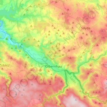
Name: Olbernhau topographic map, elevation, terrain.

Location: Olbernhau, Erzgebirgskreis, Saxony, 09526, Germany (50.59679 13.23731 50.75304 13.44796)

Average elevation: 612 m

Minimum elevation: 392 m

Maximum elevation: 842 m

Gear up for your next adventure:

🛏️Camping Sleeping Mat - Comfortable mats for sleeping outdoors
🦟Insect Repellent - Keep mosquitoes and black flies away in wooded areas
🥾All-Terrain Hiking Boots - Versatile boots for varied hiking conditions
🥾Mountain Trail Shoes - High-traction shoes for mountain trails
🔦LED Headlamp - Hands-free lighting for early morning starts or late finishes

As an Amazon Associate, this site earns from qualifying purchases at no extra cost to you.