
La Gomera topographic map
Interactive map
Click on the map to display elevation.
About this map
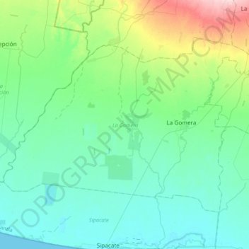
Name: La Gomera topographic map, elevation, terrain.
Location: La Gomera, Escuintla, Guatemala (13.97210 -91.28397 14.19325 -90.95943)
Average elevation: 41 m
Minimum elevation: 0 m
Maximum elevation: 208 m
Other topographic maps
Click on a map to view its topography, its elevation and its terrain.