Geolocate

Cenlle topographic map

Click on the map to display elevation.

About this map
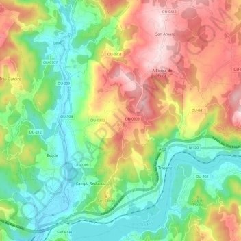
Name: Cenlle topographic map, elevation, terrain.

Location: Cenlle, O Ribeiro, Ourense, Galicia, Spain (42.30236 -8.12435 42.38114 -8.00574)

Average elevation: 247 m

Minimum elevation: 71 m

Maximum elevation: 506 m

Other topographic maps

Click on a map to view its topography, its elevation and its terrain.

Berán

Spain > Galicia > O Ribeiro > Leiro

Average elevation: 243 m

Gear up for your next adventure:

🥾Hiking Leggings - Comfortable leggings for outdoor activities
⛺Family Camping Tent - Spacious tent suitable for family camping trips
🥾Mountain Trail Shoes - High-traction shoes for mountain trails
👟Leg Gaiters - Keep debris, mud, and snow out of your boots
⛺Tent Footprint - Protect tent floor and increase durability

As an Amazon Associate, this site earns from qualifying purchases at no extra cost to you.