
Saint Peter Port topographic map
Interactive map
Click on the map to display elevation.
About this map
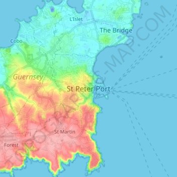
Name: Saint Peter Port topographic map, elevation, terrain.
Location: Saint Peter Port, Guernsey, GY1, Guernsey (49.41681 -2.57900 49.49681 -2.49900)
Average elevation: 23 m
Minimum elevation: -23 m
Maximum elevation: 105 m