
Thank you for supporting this site ❤️
Make a donation
Make a donation
Gear up for your next adventure:
As an Amazon Associate, this site earns from qualifying purchases at no extra cost to you.
Bourouba topographic map
Click on the map to display elevation.
Thank you for supporting this site ❤️
Make a donation
Make a donation
Gear up for your next adventure:
As an Amazon Associate, this site earns from qualifying purchases at no extra cost to you.
About this map
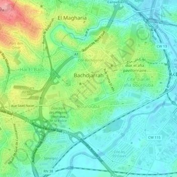
Name: Bourouba topographic map, elevation, terrain.
Location: Bourouba, El Harrach District, Algiers, Algeria (36.70349 3.08933 36.73113 3.13296)
Average elevation: 36 m
Minimum elevation: -1 m
Maximum elevation: 118 m
Thank you for supporting this site ❤️
Make a donation
Make a donation
Gear up for your next adventure:
As an Amazon Associate, this site earns from qualifying purchases at no extra cost to you.
Other topographic maps
Click on a map to view its topography, its elevation and its terrain.
Cité diar el afia bourouba
Algeria > Algiers > El Harrach District > Cité diar el afia bourouba
Average elevation: 25 m