
Make a donation
Gear up for your next adventure:
As an Amazon Associate, this site earns from qualifying purchases at no extra cost to you.
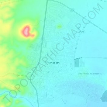
Rehoboth topographic map
Click on the map to display elevation.
Make a donation
Gear up for your next adventure:
As an Amazon Associate, this site earns from qualifying purchases at no extra cost to you.
Rehoboth
Rehoboth is a town in central Namibia just north of the Tropic of Capricorn. Located 90 kilometres (55 miles) south of the Namibian capital Windhoek, Rehoboth lies on a high elevation plateau with several natural hot-water springs. It receives sparse mean annual rainfall of 240 millimetres (9.4 in), although in the 2010/2011 rainy season a record 731 millimetres (28.8 in) were measured. In 2005, it had a population of 21,378 later increased to 28,843 in 2011, according to the 2011 Namibian Population and Housing Census.
Make a donation
Gear up for your next adventure:
As an Amazon Associate, this site earns from qualifying purchases at no extra cost to you.
About this map
Name: Rehoboth topographic map, elevation, terrain.
Location: Rehoboth, Hardap, Namibia (-23.33571 17.06652 -23.28598 17.10913)
Average elevation: 1,408 m
Minimum elevation: 1,377 m
Maximum elevation: 1,549 m
Make a donation
Gear up for your next adventure:
As an Amazon Associate, this site earns from qualifying purchases at no extra cost to you.