Geolocate

Arefu topographic map

Click on the map to display elevation.

About this map

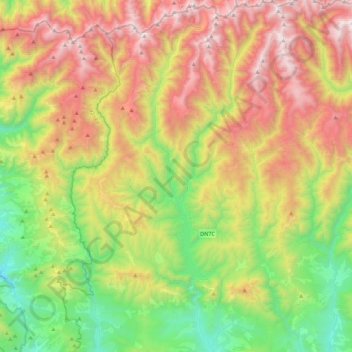
Name: Arefu topographic map, elevation, terrain.

Location: Arefu, Argeș, Romania (45.30273 24.51601 45.60837 24.74346)

Average elevation: 1,319 m

Minimum elevation: 482 m

Maximum elevation: 2,506 m

Gear up for your next adventure:

🥾Waterproof Hiking Boots - Boots keeping your feet dry in wet conditions
🧭Orienteering Kit - Tools for map reading and navigation in the wild
🧭GPS Tracker - Track your location in remote areas safely
🔪Outdoor Multitool - Versatile tool for repairs and food prep in the wild
🦯Trekking Poles - Reduced impact on joints for steep topographic climbs

As an Amazon Associate, this site earns from qualifying purchases at no extra cost to you.