
Thank you for supporting this site ❤️
Make a donation
Make a donation
Gear up for your next adventure:
As an Amazon Associate, this site earns from qualifying purchases at no extra cost to you.
Mersin topographic map
Click on the map to display elevation.
Thank you for supporting this site ❤️
Make a donation
Make a donation
Gear up for your next adventure:
As an Amazon Associate, this site earns from qualifying purchases at no extra cost to you.
About this map
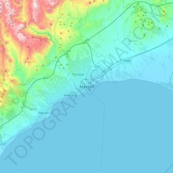
Name: Mersin topographic map, elevation, terrain.
Location: Mersin, Akdeniz, Mersin, Mediterranean Region, 33060, Turkey (36.63784 34.46984 36.95784 34.78984)
Average elevation: 149 m
Minimum elevation: -1 m
Maximum elevation: 1,186 m
Thank you for supporting this site ❤️
Make a donation
Make a donation
Gear up for your next adventure:
As an Amazon Associate, this site earns from qualifying purchases at no extra cost to you.