Geolocate

Tubac topographic map

Click on the map to display elevation.

About this map

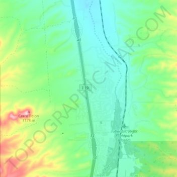
Name: Tubac topographic map, elevation, terrain.

Location: Tubac, Santa Cruz County, Arizona, 85646, United States (31.59484 -111.07885 31.66418 -111.03423)

Average elevation: 1,010 m

Minimum elevation: 947 m

Maximum elevation: 1,170 m

Gear up for your next adventure:

🧦Crew Hiking Socks - Comfortable socks for long-distance hikes
Lightweight Camping Tent - Portable shelter optimized for Canadian backcountry camping
❄️Traction Ice Cleats - Slip-on spikes for icy trails and winter hiking
🥾Waterproof Trail Shoes - Shoes designed to handle wet terrain
🛁Quick-Dry Microfiber Towel - Space-saving towel that dries rapidly on the move

As an Amazon Associate, this site earns from qualifying purchases at no extra cost to you.