Geolocate

Wendover topographic map

Click on the map to display elevation.

About this map

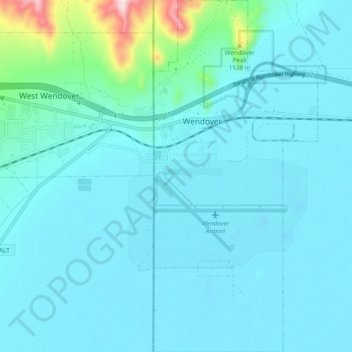
Name: Wendover topographic map, elevation, terrain.

Location: Wendover, Tooele County, Utah, United States (40.68974 -114.04381 40.76227 -113.99902)

Average elevation: 1,325 m

Minimum elevation: 1,279 m

Maximum elevation: 1,770 m

Gear up for your next adventure:

🥤Collapsible Travel Cup - Saves space and weight in your mess kit
🦶Anti-Blister Balm - Prevents friction and hotspots during long ascents
🔭Compact Binoculars - Lightweight optics for scouting trails and wildlife
🩹Compact First Aid Kit - Pre-packed essentials for common trail injuries
🥾Trail Hiking Socks - Comfortable socks to prevent blisters and fatigue

As an Amazon Associate, this site earns from qualifying purchases at no extra cost to you.