Geolocate

Pacaycasa topographic map

Click on the map to display elevation.

About this map

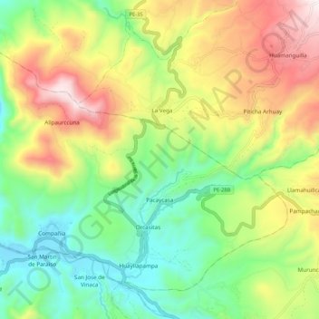
Name: Pacaycasa topographic map, elevation, terrain.

Location: Pacaycasa, Ayacucho, Peru (-13.08704 -74.27905 -13.00273 -74.17374)

Average elevation: 2,825 m

Minimum elevation: 2,411 m

Maximum elevation: 3,451 m

Other topographic maps

Click on a map to view its topography, its elevation and its terrain.

Santa Fe

Peru > Ayacucho

Average elevation: 4,522 m

Gear up for your next adventure:

🥾Trekking Boots - Durable boots for long-distance trekking
👖Convertible Hiking Pants - Zip-off legs to adapt to changing weather conditions
🔭Compact Monocular - One-handed bird watching and trail spotting
🥫Freeze-Dried Meals - Lightweight, high-calorie nutrition for multi-day treks
🧴Sunscreen SPF - Broad-spectrum sunscreen for outdoor activities

As an Amazon Associate, this site earns from qualifying purchases at no extra cost to you.