
Thank you for supporting this site ❤️
Make a donation
Make a donation
Gear up for your next adventure:
As an Amazon Associate, this site earns from qualifying purchases at no extra cost to you.
Tumaco topographic map
Click on the map to display elevation.
Thank you for supporting this site ❤️
Make a donation
Make a donation
Gear up for your next adventure:
As an Amazon Associate, this site earns from qualifying purchases at no extra cost to you.
About this map
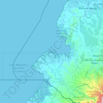
Name: Tumaco topographic map, elevation, terrain.
Location: Tumaco, Pacífico Sur, Nariño, RAP Pacífico, Colombia (1.18750 -79.00785 2.44861 -78.25566)
Average elevation: 49 m
Minimum elevation: -5 m
Maximum elevation: 1,796 m
Thank you for supporting this site ❤️
Make a donation
Make a donation
Gear up for your next adventure:
As an Amazon Associate, this site earns from qualifying purchases at no extra cost to you.