Geolocate

Éveux topographic map

Click on the map to display elevation.

About this map
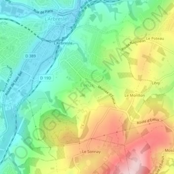
Name: Éveux topographic map, elevation, terrain.

Location: Éveux, Villefranche-sur-Saône, Rhône, Auvergne-Rhône-Alpes, Metropolitan France, 69210, France (45.81608 4.60628 45.83519 4.63816)

Average elevation: 320 m

Minimum elevation: 221 m

Maximum elevation: 477 m

Other topographic maps

Click on a map to view its topography, its elevation and its terrain.

Grand Pré

France > Auvergne-Rhône-Alpes > Rhône > Fleurie

Average elevation: 318 m

Gear up for your next adventure:

🧰Emergency Multi-Tool - Compact multi-tool for outdoor survival
🧼Travel Hand Sanitizer - Keep hands clean when water is scarce
🔥Camping Stove - Portable stoves to cook outdoors with ease
🔋Solar Power Bank - Keep your GPS and devices charged during long outdoor trips
🥾Lightweight Hiking Boots - Boots for comfort and mobility on long hikes

As an Amazon Associate, this site earns from qualifying purchases at no extra cost to you.