Geolocate

Olympiapark topographic map

Click on the map to display elevation.

About this map

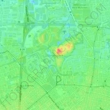
Name: Olympiapark topographic map, elevation, terrain.

Location: Olympiapark, Munich, Bavaria, Germany (48.16150 11.53834 48.17607 11.56096)

Average elevation: 516 m

Minimum elevation: 494 m

Maximum elevation: 556 m

Other topographic maps

Click on a map to view its topography, its elevation and its terrain.

Messesee

Germany > Bavaria > Munich

Average elevation: 527 m

Freiham

Germany > Bavaria > Munich

Average elevation: 531 m

19.5

Germany > Bavaria > Munich

Average elevation: 569 m

Domagkpark

Germany > Bavaria > Munich

Average elevation: 505 m

Berg am Laim

Germany > Bavaria > Munich

Average elevation: 532 m

Gear up for your next adventure:

🦟Insect Repellent - Keep mosquitoes and black flies away in wooded areas
🥾Trail Hiking Shoes - Durable shoes designed for rugged trails
🧊Insulated Water Bottle - Keeps drinks cold in summer and prevents freezing in winter
🛶Kayak Accessories - Essential gear for safe and fun kayaking adventures
👖Convertible Hiking Pants - Zip-off legs to adapt to changing weather conditions

As an Amazon Associate, this site earns from qualifying purchases at no extra cost to you.