Geolocate

Perinaldo topographic map

Click on the map to display elevation.

About this map

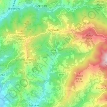
Name: Perinaldo topographic map, elevation, terrain.

Location: Perinaldo, Imperia, Liguria, 18032, Italy (43.83036 7.64671 43.88025 7.72403)

Average elevation: 390 m

Minimum elevation: 27 m

Maximum elevation: 1,012 m

Gear up for your next adventure:

🧰Multitool Knife - Compact and versatile tool for outdoor use
🥾Trekking Poles - Adjustable trekking poles to reduce knee stress and improve stability
🥾Trail Hiking Shoes - Durable shoes designed for rugged trails
🎒Hiking Backpack - Lightweight and ergonomic backpacks for day hikes or multi-day treks
Bushcraft Tarp - Versatile emergency shelter or gear protection

As an Amazon Associate, this site earns from qualifying purchases at no extra cost to you.