Leysin topographic map
Click on the map to display elevation.
Leysin
The municipality is located in the Aigle district, on the right side of the Grande-Eau at the foot of the Tour d'Aï and the Tour de Mayen. The main village is located at an elevation of 1,260 m (4,130 ft). It consists of the village of Leysin and the hamlets of Veyges, Feydey, Aï, and Mayen.
About this map
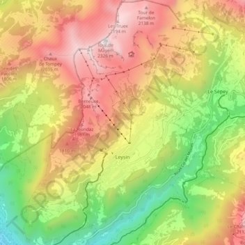
Name: Leysin topographic map, elevation, terrain.
Location: Leysin, District d'Aigle, Vaud, 1854, Switzerland (46.32070 6.97711 46.38518 7.04051)
Average elevation: 1,352 m
Minimum elevation: 415 m
Maximum elevation: 2,299 m
Other topographic maps
Click on a map to view its topography, its elevation and its terrain.