
Thank you for supporting this site ❤️
Make a donation
Make a donation
Gear up for your next adventure:
As an Amazon Associate, this site earns from qualifying purchases at no extra cost to you.
Reliegos topographic map
Click on the map to display elevation.
Thank you for supporting this site ❤️
Make a donation
Make a donation
Gear up for your next adventure:
As an Amazon Associate, this site earns from qualifying purchases at no extra cost to you.
About this map
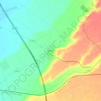
Name: Reliegos topographic map, elevation, terrain.
Location: Reliegos, Santas Martas, León, Castile and León, 24339, Spain (42.45491 -5.37481 42.49491 -5.33481)
Average elevation: 828 m
Minimum elevation: 803 m
Maximum elevation: 858 m
Thank you for supporting this site ❤️
Make a donation
Make a donation
Gear up for your next adventure:
As an Amazon Associate, this site earns from qualifying purchases at no extra cost to you.