Geolocate

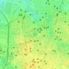
Indore topographic map

Click on the map to display elevation.

About this map
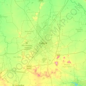
Name: Indore topographic map, elevation, terrain.

Location: Indore, Juni Indore Tahsil, Indore, Madhya Pradesh, 452001, India (22.56036 75.70820 22.88036 76.02820)

Average elevation: 555 m

Minimum elevation: 445 m

Maximum elevation: 775 m

Other topographic maps

Click on a map to view its topography, its elevation and its terrain.
Saraswati

India > Madhya Pradesh > Juni Indore Tahsil

Average elevation: 564 m

ganga river

India > Madhya Pradesh > Juni Indore Tahsil > Indore

Average elevation: 556 m

ganga river

India > Madhya Pradesh > Juni Indore Tahsil > Indore

Average elevation: 556 m

Gear up for your next adventure:

🚲Bike Repair Kit - Essential tools for on-trail mechanical issues
🩹Compact First Aid Kit - Pre-packed essentials for common trail injuries
🏃Hydration Running Vest - Carry water and maps close to your body for speed
🧣Evaporative Cooling Towel - Beat the heat during intense summer climbs
🔭Compact Monocular - One-handed bird watching and trail spotting

As an Amazon Associate, this site earns from qualifying purchases at no extra cost to you.