Geolocate

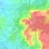
Bazouges Cré sur Loir topographic map

Click on the map to display elevation.

About this map

Name: Bazouges Cré sur Loir topographic map, elevation, terrain.

Location: Bazouges Cré sur Loir, La Flèche, Sarthe, Pays de la Loire, Metropolitan France, 72200, France (47.63235 -0.22014 47.71924 -0.10556)

Average elevation: 41 m

Minimum elevation: 20 m

Maximum elevation: 100 m

Other topographic maps

Click on a map to view its topography, its elevation and its terrain.

Pontenchéri

France > Pays de la Loire > Sarthe > Courdemanche

Average elevation: 112 m

L'Armenaudière

France > Pays de la Loire > Sarthe > Écommoy

Average elevation: 116 m

La Thibaudière

France > Pays de la Loire > Sarthe > Arçonnay

Average elevation: 158 m

Gear up for your next adventure:

🧥Softshell Jacket - Windproof and breathable jacket for hiking
🥾Trekking Poles - Adjustable trekking poles to reduce knee stress and improve stability
🛌Insulated Sleeping Pad - Critical thermal barrier between you and the cold ground
🥾Mountain Hiking Shoes - Shoes with superior grip for mountainous terrain
🥾Waterproof Hiking Boots - Essential footwear for rugged terrain and wet Canadian trails

As an Amazon Associate, this site earns from qualifying purchases at no extra cost to you.