Geolocate

Deqing County topographic map

Click on the map to display elevation.

About this map

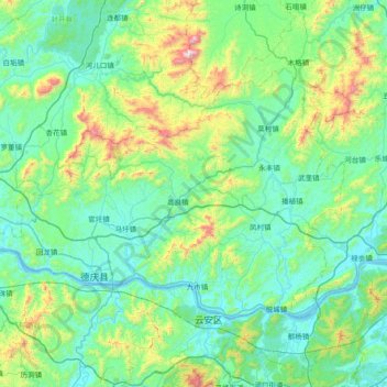
Name: Deqing County topographic map, elevation, terrain.

Location: Deqing County, Zhaoqing City, Guangdong Province, China (23.07338 111.52865 23.51146 112.26559)

Average elevation: 218 m

Minimum elevation: -2 m

Maximum elevation: 1,249 m

Other topographic maps

Click on a map to view its topography, its elevation and its terrain.

Du Village

China > Guangdong Province > Zhaoqing City

Average elevation: 96 m

Gear up for your next adventure:

🧢Hiking Hat - Sun-protective and breathable hats for long treks
🎒Hiking Backpack - Lightweight and ergonomic backpacks for day hikes or multi-day treks
🥾Hiking Shorts - Breathable shorts suitable for summer hikes
🥾All-Terrain Hiking Boots - Versatile boots for varied hiking conditions
🌬️Windproof Camp Stove - Efficient cooking even on exposed mountain peaks

As an Amazon Associate, this site earns from qualifying purchases at no extra cost to you.