
Thank you for supporting this site ❤️
Make a donation
Make a donation
Gear up for your next adventure:
As an Amazon Associate, this site earns from qualifying purchases at no extra cost to you.
Güzelyayla topographic map
Click on the map to display elevation.
Thank you for supporting this site ❤️
Make a donation
Make a donation
Gear up for your next adventure:
As an Amazon Associate, this site earns from qualifying purchases at no extra cost to you.
About this map
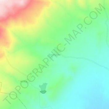
Name: Güzelyayla topographic map, elevation, terrain.
Location: Güzelyayla, Horasan, Erzurum, Eastern Anatolia Region, Turkey (40.03905 41.95292 40.07905 41.99292)
Average elevation: 1,792 m
Minimum elevation: 1,633 m
Maximum elevation: 2,114 m
Thank you for supporting this site ❤️
Make a donation
Make a donation
Gear up for your next adventure:
As an Amazon Associate, this site earns from qualifying purchases at no extra cost to you.