
Tavistock topographic map
Click on the map to display elevation.
About this map
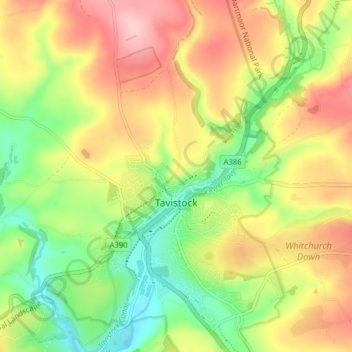
Name: Tavistock topographic map, elevation, terrain.
Location: Tavistock, West Devon, Devon, England, United Kingdom (50.52837 -4.16663 50.57838 -4.11257)
Average elevation: 139 m
Minimum elevation: 60 m
Maximum elevation: 227 m
Other topographic maps
Click on a map to view its topography, its elevation and its terrain.
Spire's Lake
United Kingdom > England > Devon > West Devon > Sampford Courtenay
Average elevation: 147 m