Geolocate

Mokila topographic map

Click on the map to display elevation.

About this map

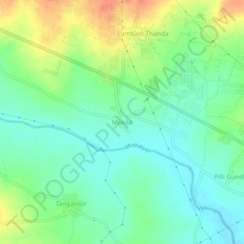
Name: Mokila topographic map, elevation, terrain.

Location: Mokila, Shankarpalle mandal, Ranga Reddy, Telangana, India (17.40632 78.16810 17.44632 78.20810)

Average elevation: 569 m

Minimum elevation: 551 m

Maximum elevation: 601 m

Gear up for your next adventure:

🧥Thermal Layer - Insulating layer for cold outdoor conditions
🔨Vehicle Emergency Tool - Safety tool for remote road trips to trailheads
🥾Hiking Shorts - Breathable shorts suitable for summer hikes
Camping Coffee Maker - Brew fresh coffee anywhere on the topographic map
🥾Waterproof Trail Shoes - Shoes designed to handle wet terrain

As an Amazon Associate, this site earns from qualifying purchases at no extra cost to you.