Geolocate

Ramnagar topographic map

Click on the map to display elevation.

About this map

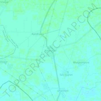
Name: Ramnagar topographic map, elevation, terrain.

Location: Ramnagar, Patiala Tahsil, Patiala, Punjab, India (30.10698 76.29696 30.14698 76.33696)

Average elevation: 242 m

Minimum elevation: 239 m

Maximum elevation: 245 m

Gear up for your next adventure:

🧢Beanie Hat - Keep your head warm in cold weather
📷Outdoor Action Camera - Capture high-elevation views and rugged adventures
🎒Fully Waterproof Backpack - Total protection for photography gear and electronics
🧣Evaporative Cooling Towel - Beat the heat during intense summer climbs
🧴First Aid Kit - Essential first aid supplies for outdoor emergencies

As an Amazon Associate, this site earns from qualifying purchases at no extra cost to you.