Geolocate

El Chaco topographic map

Click on the map to display elevation.

About this map

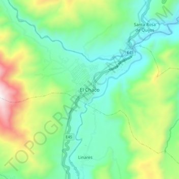
Name: El Chaco topographic map, elevation, terrain.

Location: El Chaco, Cantón El Chaco, Napo, Ecuador (-0.37866 -77.84985 -0.29866 -77.76985)

Average elevation: 1,783 m

Minimum elevation: 1,405 m

Maximum elevation: 2,693 m

Gear up for your next adventure:

🧥Packable Rain Jacket - Breathable waterproof layer for unpredictable weather
🧴Insect Repellent - Protect yourself from bugs during outdoor adventures
🐕Hiking Dog Pack - Let your canine companion carry their own water and food
🦟Insect Repellent - Keep mosquitoes and black flies away in wooded areas
🧴First Aid Kit - Essential first aid supplies for outdoor emergencies

As an Amazon Associate, this site earns from qualifying purchases at no extra cost to you.