Geolocate

Jelsa topographic map

Click on the map to display elevation.

About this map

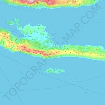
Name: Jelsa topographic map, elevation, terrain.

Location: Jelsa, Split-Dalmatia County, Croatia (43.07972 16.58693 43.19949 16.98033)

Average elevation: 49 m

Minimum elevation: -1 m

Maximum elevation: 773 m

Other topographic maps

Click on a map to view its topography, its elevation and its terrain.

Gear up for your next adventure:

🥾Waterproof Trail Shoes - Shoes designed to handle wet terrain
🕶️Polarized Sunglasses - Reduces glare from snow and water at high elevations
🧴Sunscreen SPF - Broad-spectrum sunscreen for outdoor activities
💡LED Headlamp - Hands-free illumination for night hiking and camping
🥾Trekking Boots - Durable boots for long-distance trekking

As an Amazon Associate, this site earns from qualifying purchases at no extra cost to you.