Geolocate

East Grinstead topographic map

Click on the map to display elevation.

About this map
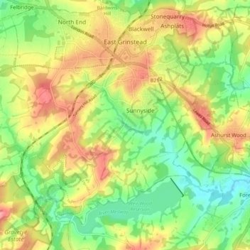
Name: East Grinstead topographic map, elevation, terrain.

Location: East Grinstead, West Sussex, England, United Kingdom (51.08623 -0.06037 51.14120 0.02779)

Average elevation: 104 m

Minimum elevation: 58 m

Maximum elevation: 156 m

Other topographic maps

Click on a map to view its topography, its elevation and its terrain.
Storrington

United Kingdom > England > West Sussex

Average elevation: 65 m

Bucks Green

United Kingdom > England > West Sussex > Horsham

Average elevation: 47 m

Gear up for your next adventure:

🥾Trail Running Shoes - Lightweight and durable shoes for trail running
🥤Collapsible Travel Cup - Saves space and weight in your mess kit
🧢Beanie Hat - Keep your head warm in cold weather
🧴Insect Repellent - Protect yourself from bugs during outdoor adventures
🛌Insulated Sleeping Pad - Critical thermal barrier between you and the cold ground

As an Amazon Associate, this site earns from qualifying purchases at no extra cost to you.