Geolocate

Pikesville topographic map

Click on the map to display elevation.

About this map
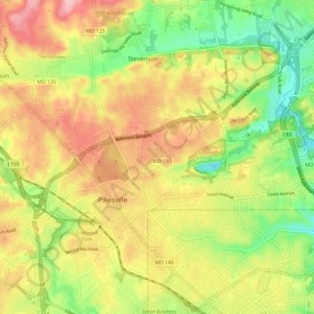
Name: Pikesville topographic map, elevation, terrain.

Location: Pikesville, Baltimore County, Maryland, United States (39.35441 -76.75580 39.41614 -76.65300)

Average elevation: 135 m

Minimum elevation: 69 m

Maximum elevation: 199 m

Gear up for your next adventure:

🕶️Polarized Sunglasses - Protect your eyes with durable polarized lenses
🧭GPS Handheld Device - Reliable GPS navigation for outdoor adventures
🪑Insulated Seat Pad - Protect your seat from cold rocks and wet logs
⛺Lightweight Backpacking Tent - Compact tent for efficient hiking trips
🧦Outdoor Socks - Durable socks designed for hiking and outdoor sports

As an Amazon Associate, this site earns from qualifying purchases at no extra cost to you.