Geolocate

Sipi topographic map

Click on the map to display elevation.

About this map

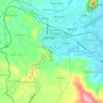
Name: Sipi topographic map, elevation, terrain.

Location: Sipi, Daraga, Albay, Bicol Region, 4501, Philippines (13.12254 123.69281 13.16254 123.73281)

Average elevation: 64 m

Minimum elevation: 9 m

Maximum elevation: 196 m

Gear up for your next adventure:

🚲Handlebar Phone Mount - View topographic-map.com live while cycling
🧊Insulated Water Bottle - Keeps drinks cold in summer and prevents freezing in winter
🧳Compression Sacks - Maximize space in your backpack by shrinking gear
🧴Bear Spray Holster - Quick-access carry for essential Canadian wilderness safety
🌬️Windproof Camp Stove - Efficient cooking even on exposed mountain peaks

As an Amazon Associate, this site earns from qualifying purchases at no extra cost to you.