
Thank you for supporting this site ❤️
Make a donation
Make a donation
Gear up for your next adventure:
As an Amazon Associate, this site earns from qualifying purchases at no extra cost to you.
Montleban topographic map
Click on the map to display elevation.
Thank you for supporting this site ❤️
Make a donation
Make a donation
Gear up for your next adventure:
As an Amazon Associate, this site earns from qualifying purchases at no extra cost to you.
About this map
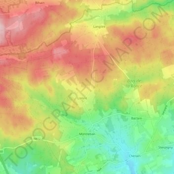
Name: Montleban topographic map, elevation, terrain.
Location: Montleban, Gouvy, Bastogne, Luxembourg, Wallonia, 6670, Belgium (50.17373 5.78809 50.23999 5.88033)
Average elevation: 509 m
Minimum elevation: 396 m
Maximum elevation: 627 m
Thank you for supporting this site ❤️
Make a donation
Make a donation
Gear up for your next adventure:
As an Amazon Associate, this site earns from qualifying purchases at no extra cost to you.