Geolocate

Waikoloa topographic map

Click on the map to display elevation.

About this map

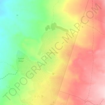
Name: Waikoloa topographic map, elevation, terrain.

Location: Waikoloa, Hawaiʻi County, Hawaii, United States (19.92693 -155.80740 19.96693 -155.76740)

Average elevation: 271 m

Minimum elevation: 133 m

Maximum elevation: 395 m

Other topographic maps

Click on a map to view its topography, its elevation and its terrain.

Pahoa CDP

United States > Hawaii > Hawaiʻi County

Average elevation: 192 m

Gear up for your next adventure:

🧢Sun Protection Cap - Breathable cap to protect from sun exposure
🔥Emergency Fire Starter - Reliable ignition source for all weather conditions
🧭Orienteering Kit - Tools for map reading and navigation in the wild
🧥Insulated Jacket - Keep warm in cold outdoor conditions
🦶Hiking Shoe Insoles - Added support for high arches and long days on feet

As an Amazon Associate, this site earns from qualifying purchases at no extra cost to you.