
Thank you for supporting this site ❤️
Make a donation
Make a donation
Gear up for your next adventure:
As an Amazon Associate, this site earns from qualifying purchases at no extra cost to you.
Mawsynram topographic map
Click on the map to display elevation.
Thank you for supporting this site ❤️
Make a donation
Make a donation
Gear up for your next adventure:
As an Amazon Associate, this site earns from qualifying purchases at no extra cost to you.
About this map
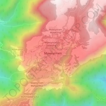
Name: Mawsynram topographic map, elevation, terrain.
Location: Mawsynram, East Khasi Hills, Meghalaya, 793113, India (25.25882 91.54245 25.33882 91.62245)
Average elevation: 1,028 m
Minimum elevation: 154 m
Maximum elevation: 1,754 m
Thank you for supporting this site ❤️
Make a donation
Make a donation
Gear up for your next adventure:
As an Amazon Associate, this site earns from qualifying purchases at no extra cost to you.