Geolocate

Breitenbach topographic map

Click on the map to display elevation.

About this map
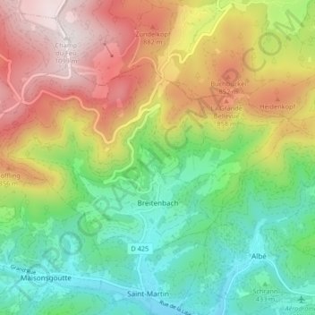
Name: Breitenbach topographic map, elevation, terrain.

Location: Breitenbach, Sélestat-Erstein, Bas-Rhin, Grand Est, Metropolitan France, 67220, France (48.35706 7.24834 48.39010 7.33045)

Average elevation: 608 m

Minimum elevation: 271 m

Maximum elevation: 1,099 m

Other topographic maps

Click on a map to view its topography, its elevation and its terrain.

Hexenmatt

France > Grand Est > Bas-Rhin > Osthouse

Average elevation: 154 m

Gear up for your next adventure:

🧰Emergency Multi-Tool - Compact multi-tool for outdoor survival
🪑Ultralight Camping Stool - Compact seating for rest stops during long hikes
🦯Trekking Poles - Reduced impact on joints for steep topographic climbs
🛶Kayak Accessories - Essential gear for safe and fun kayaking adventures
🥾Hiking Boots - Sturdy boots providing ankle support and traction on rugged trails

As an Amazon Associate, this site earns from qualifying purchases at no extra cost to you.