

Bhimeshwar topographic map
Click on the map to display elevation.
Bhimeshwar
Bhimeshwar, (formerly Charikot), is a municipality in north-eastern Nepal and the headquarters of Dolakha District in Bagmati Province that was established in 1997 by merging the former Village development committees Charikot, Dolakha Town, Makaibari, Mati, Suspaa, and Lankuri danda . At the time of the 2011 Nepal census, it had a population of 32,486 people living in 8,639 individual households. The town is located at an altitude of 1,554 metres (5,101 feet). The name of the district Dolakha came from Dolakha Town situated north-east of the headquarters Charikot Bazaar.
About this map
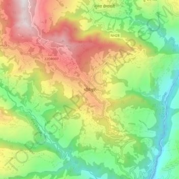
Name: Bhimeshwar topographic map, elevation, terrain.
Location: Bhimeshwar, Bhimeshwor, Dolakha, Bagmati Province, Nepal (27.62356 86.00883 27.70356 86.08883)
Average elevation: 1,583 m
Minimum elevation: 843 m
Maximum elevation: 2,626 m